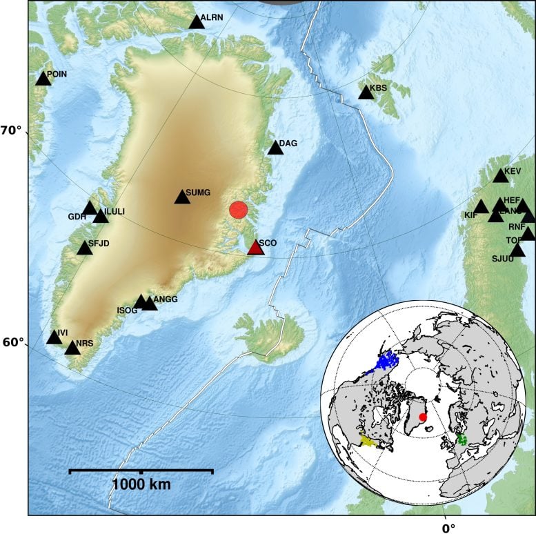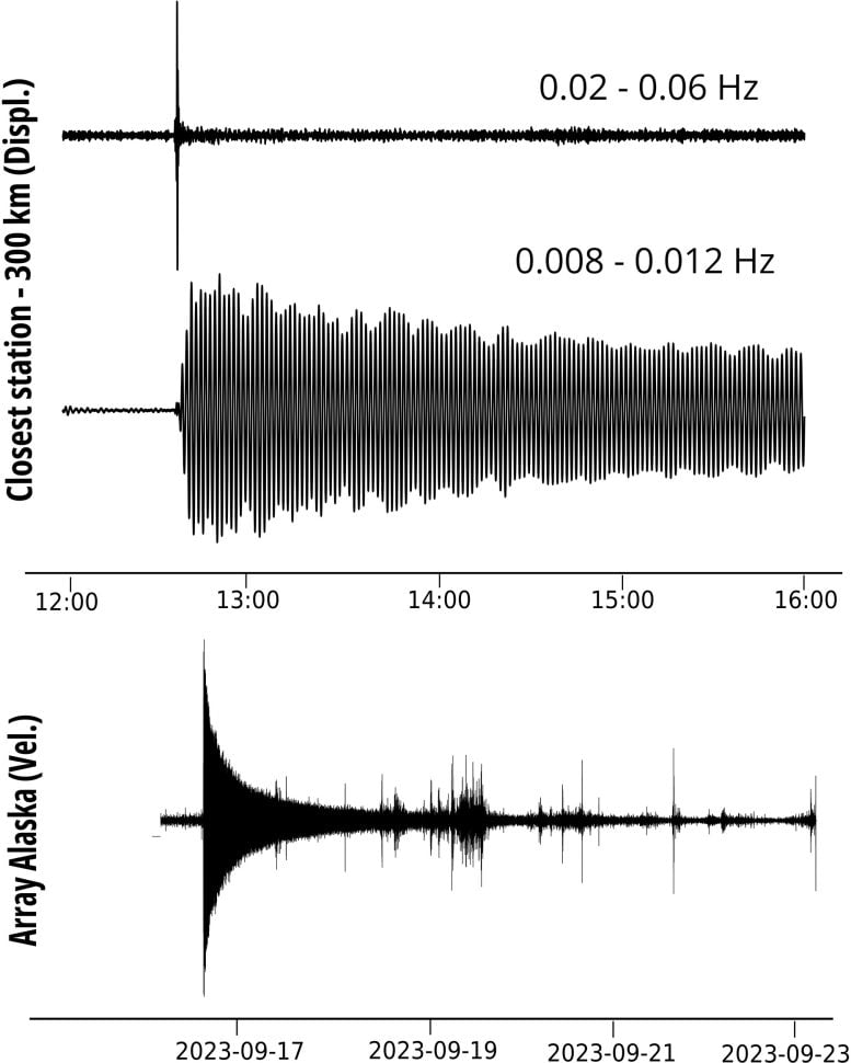
Seismologists measure earthquakes at distances of up to 5,000 kilometers.
On September 16, 2023, a massive wave hit a fjord on the east coast of Greenland, leaving behind traces of flooding that were up to 200 meters high in some areas. Researchers led by Angela Carrillo Ponce of the German Research Center for Geosciences (GFZ) have analyzed seismic data from earthquake monitoring stations around the world and discovered another remarkable event. The megatsunami triggered a standing wave that swayed back and forth in the narrow, uninhabited Dickson Fjord for over a week. The international team has published its findings in the journal The seismic recordings.

Rockfall as a triggering event
The tsunami was triggered by a large landslide. Earthquake measuring stations up to 5,000 kilometers away registered the tremors of the landslide as a short signal. However, there was also a very long period (VLP) signal that the seismometers recorded for more than a week. Angela Carrillo Ponce, a doctoral student in the “Earthquake and Volcano Physics” section of the GFZ, says: “The fact alone that the VLP signal of a sloshing wave triggered by a landslide in a remote area of Greenland can be observed worldwide and for more than a week is exciting. That is why we have been most concerned with this signal in seismology.” Fortunately, says the researcher, no one was hurt. Only a military base that was unmanned at the time of the tsunami was devastated.
Analysis of the seismic signals – shock waves that travel thousands of kilometers in the Earth’s crust – showed that a so-called standing wave had formed in the fjord after the landslide. The parts of the flank that fell into the water initially triggered a huge wave that spread through the entire fjord to the offshore island of Ella, more than 50 kilometers away. Near the point where the landslide entered the fjord, the maximum height was more than 200 meters, and along the coast it averaged 60 meters. Parts of the wave apparently sloshed back from the steep banks in the narrow fjord and a standing wave began to form that swayed back and forth for more than a week. This wave, however, was only about 1 meter high.

Standing wave persisted for an unusually long time
Such standing waves and the resulting long-period signals are already known from research. Normally, such VLP signals are associated with large breaks at glacier edges. “In our case, we also registered a VLP signal,” says Angela Carrillo Ponce, “the unusual thing about it was its long duration.” What was particularly impressive was that the data from seismic stations in Germany, Alaska and other parts of North America were of very good quality for the analysis. A comparison with satellite images confirmed that the cause of the first seismic signals corresponded well with the strength and direction of the rockfall that triggered the megatsunami. In addition, the authors were able to model the slow decay and the dominant oscillation period of the VLP signals.
This gives researchers hope that they will be able to identify and analyze other similar events from the past in the future. It is obvious that the retreat of glaciers, which used to fill entire valleys, and the thawing of permafrost are leading to increased landslides. Climate change is accelerating the melting of glaciers and could therefore increase the risk of megatsunamis.
Reference: “The Greenland megatsunami of 16 September 2023: Analysis and modelling of the source and a week-long monochromatic seismic signal” by Angela Carrillo-Ponce, Sebastian Heimann, Gesa M. Petersen, Thomas R. Walter, Simone Cesca and Torsten Dahm, 8 August 2024, The seismic recording.
DOI: 10.1785/0320240013


